Validating The Conflation
Every feature must be validated before it can be uploaded to
OpenStreetMap. OSM discourages automated
edits
without human intervention. This software doesn't make any geometry
changes, just tags, but still needs to be reviewed carefully.
At it's core, conflation is just merging tags between datasets to avoid tedious cut & paste. But this still needs to be validated as bugs and inconsistencies in the datasets can sneak in.
My Process
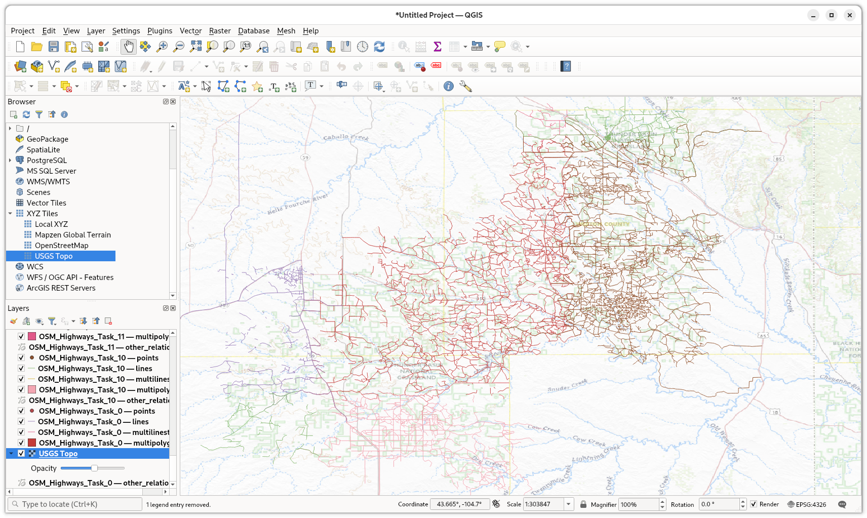
I have the two datasets that I was conflating loaded as layers in JOSM so I can check the original sources easily if needed. Since these are remote highways and trails, I use the USGS topographical basemap in JOSM. Course that can also lead to confusion as sometimes the reference number in the basemap has been truncated. When in doubt, I reference the latest dataset from the national forest service, which is the most correct. That dataset is in vtpk format, so doesn't work in JOSM, so I run it in QGIS.
Debug Tags
Currently a few tags are added to each feature to aid in validating and debugging the conflation algorythm. These should obviously be removed before uploading to OSM. They'll be removed at a future date after more validation of the software. These are:
- hits - The number of matching tags in a feature
- ratio - The ratio for name matching if not 100%
- dist - The distance between features
- angle - The angle between two features
- slope - The slope between two features
If a feature has 3 hits, that's probably an exact match. One hit is sufficient if there are no other nearby highways or trails. Two hits usually means the name and reference number matched. If a highway only contains highway=path, but the distance is very small, and there are no other nearby features, it's assumed to be a match. Modifying the current thresholds for distance, angle, and slope changes the results, so having these as temporary tags in the feature is useful when validating conflation results.
Missed Highway
Sometimes you see an external trail or highway that is not in the conflated data. This is because that highway is not currently in OSM, so we ignore it since we're focused on existing features.
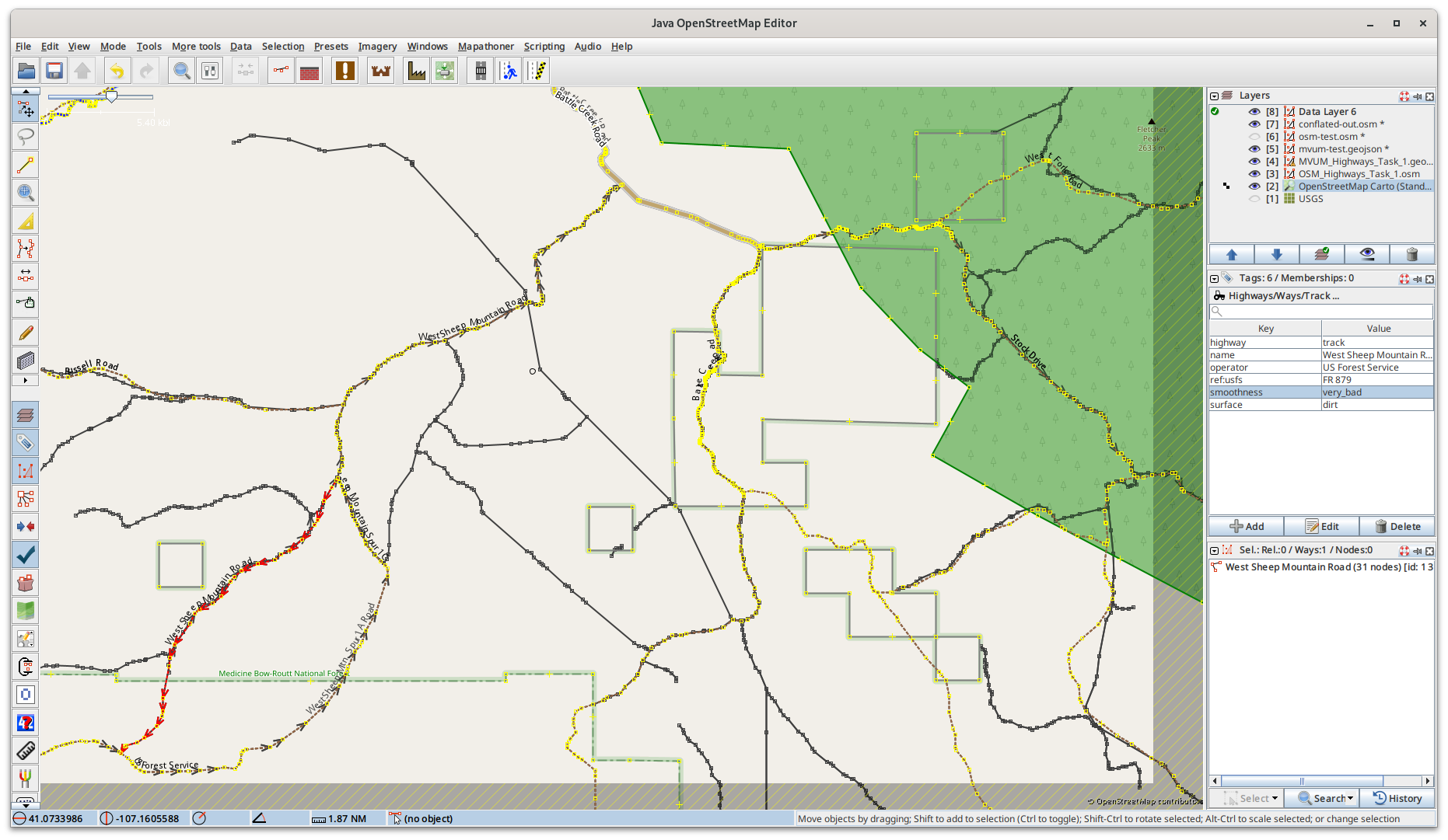
When youhave the external dataset and OSM loaded in JOSM as layers, this screenshot shows the other layers under the conflated data and show as black lines. It's easy to see which layer it came from by toggling the layers on and off.
The conflation software can also produce a data file of highways in the MVUM dataset that aren't in OSM. Importing those is a different process, so not discussed here. The conflation software can also produce a data file of all the trails in OSM that are not in any official sources.
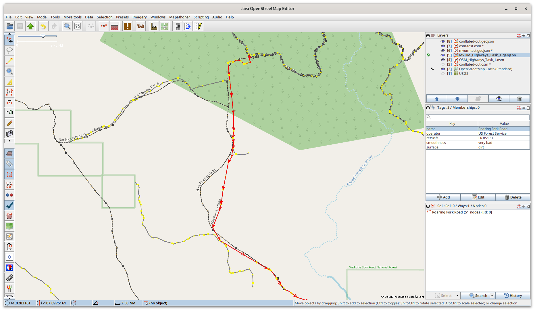
Missing Segments
Sometimes the external datset has missing segments, where OSM has the entire highway. You can see in this screenshot of an MVUM highway on top of an OSM basemap. The MVUM highway is missing the middle segment.
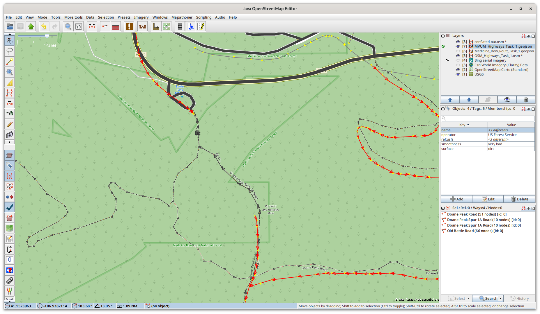
The conflation software sucessfully merges the tags from the external dataset to the complete OSM highway feature.
Currently any features that are an exact match between the external dataset and OSM are not in the conflated output to reduce the data that needs to be validated. If you have OSM loaded into a layer in JOSM, the matched segments will be black lines.
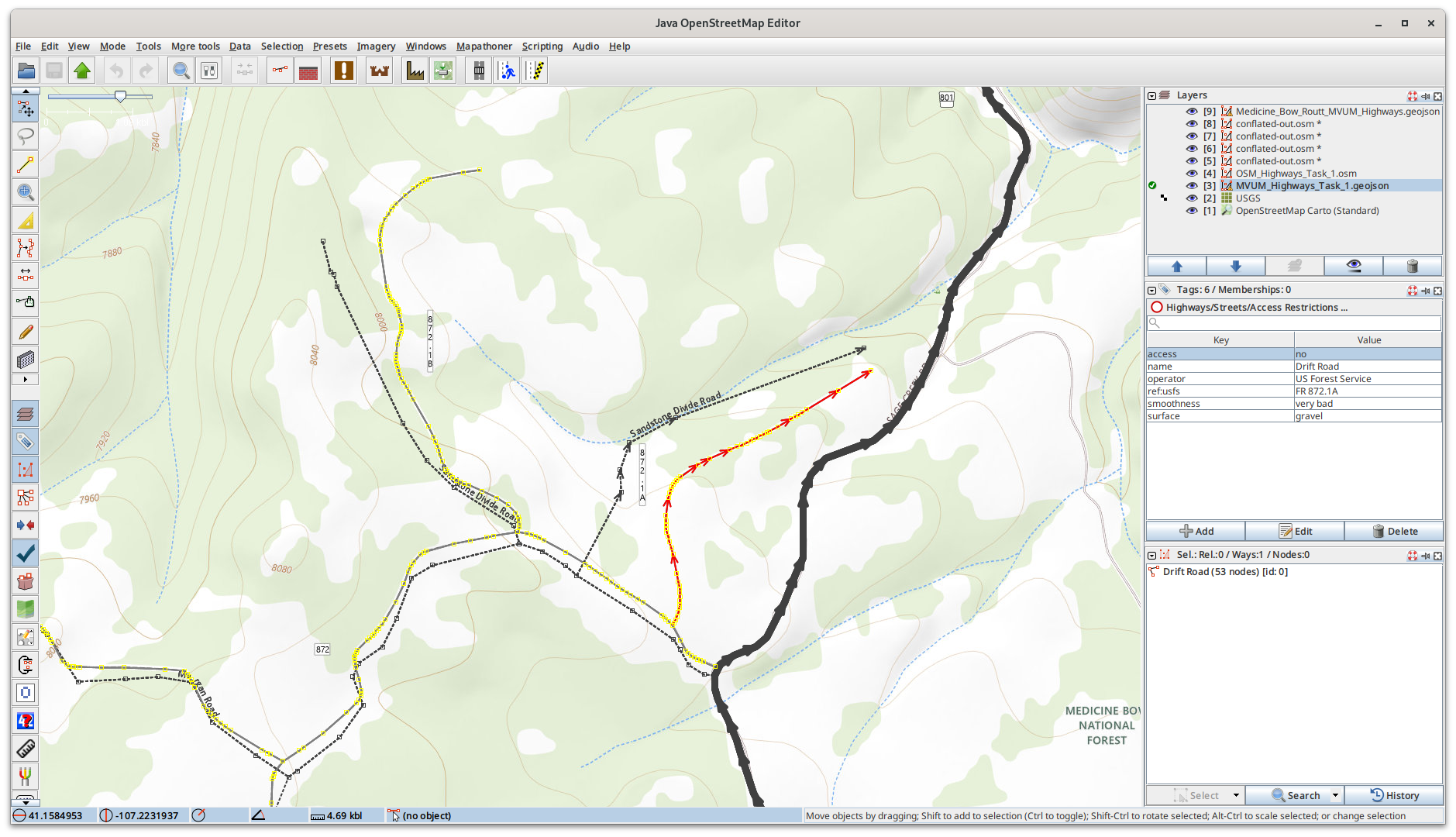
Reference Numbers Don't Match
If you are using the USGS topographical basemap, you can't depend on it for the official reference number. Often the reference numbers in the basemap are truncated, so you may think there is a problem. The reference number in the MVUM dataset is the correct one.
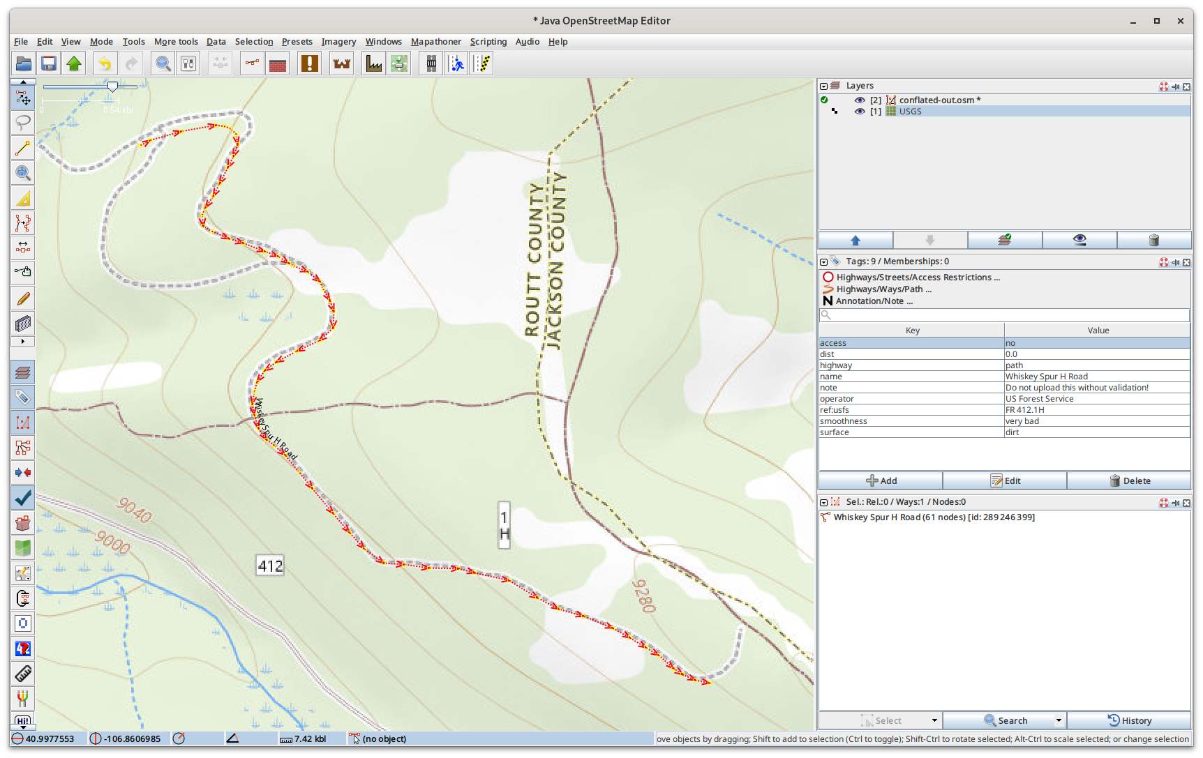
The other issue with reference numbers is also related to them being truncated. Older versions of the external datasets are often missing the .1 suffix. All the newer versions of the MVUM dataset and the USGS topographical maps do have the full reference number with the .1 appended. Depending on when the data was imported into OSM, it may be lacking the .1 suffix.
Proper Abbreviation
The community accepted abbreviation for Forest Service Road is FR. The MVUM dataset of course lacks this abbreviation, but it's added when converting the MVUM dataset to OSM. In OSM there is a wide variety of variations on this, some examples are usfs *, *usfsr, FD, FS, etc... The conversion process also looks for these and makes them consistent with OSM by using only FR. If they are converteds, the existing value in OSM is renamed to old_ref, so when validating the conflated data, you'll see both, and the old value can be deleted.
Proper Tag
One of the wonderful things about the flexibility of thw data schema to support multiple values for the same feature. An MVUM highway will of course have a reference number, but it may also have a county reference number.
Based on a long discussion on the OSM Tagging email list a few years ago, the consensus was to use ref for the county reference number, and ref:usfs for the forest service number. The OSM carto will display anything with a ref* tag. The conflation process also looks for a forest service reference number under a ref_ tag, and changes it to use ref:usfs. Both versions are displayed in the conflated data, you can delete the older one under ref.
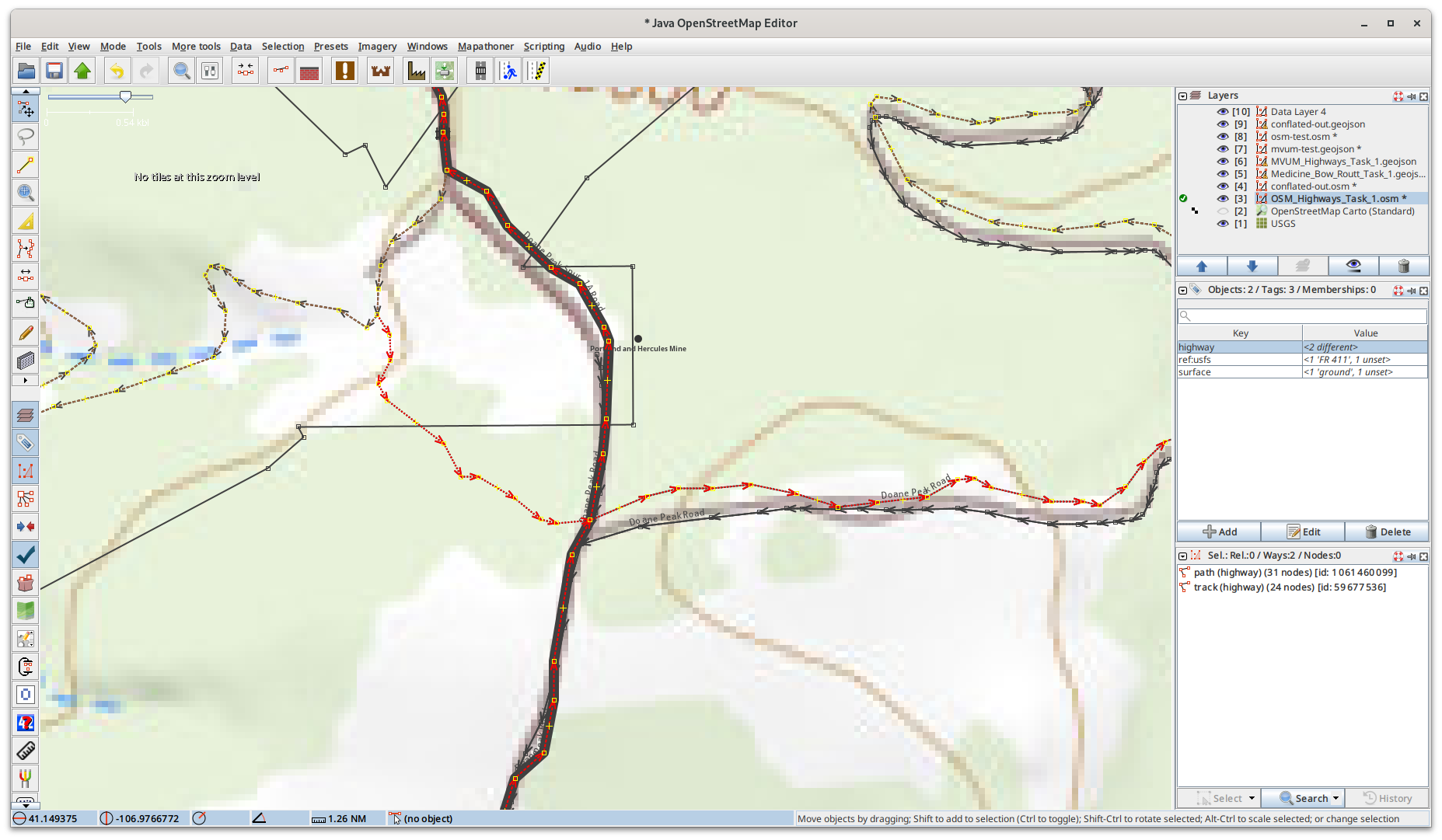
Geometry Matching
If the distance, the slope, and the angle are all zero, that's an exact match of geometries. Usually these highways segments were imported from the same external dataset I'm conflating, so identical other than lacking metadata. These an easy to validate since we have high confidence the external feature matches the OSM feature.
Sometimes though you get a similar geometry, but they are parallel. This happens for highways that were traced off of satellite imagery as the offsets vary. You can see in this screenshot that the conflation software sucessfully made the match, and the merged the tags into the OSM feature, which currently is only highway=track. At some point it'd be good to go back through and fix the geometry, but for now we're just focused on improving the tags.
When highways are traced from satellite imagery, sometimes they don't match the geometry in the external dataset. While too much differences in geometry can lead to false positives, we don't want to only identify an exact match. There are steering paramaters on how much difference is acceptable.
Splitting Forks
While this project is focused on conflating metadata, and not making geometry changes, sometimes when validating the conflation results I come across problems. Usually in OSM these are just tagged with highway=track, and were obviously traced from satellite imagery. Unfortunately without another dataset to reference, sometimes the highway continues on the wrong branch of the fork. This obviously gets flagged by the conflation process, but needs to be fixed manually.
I try to fix these as I come across them as I'm validating the conflation results. Since conflation is not fast, I have time between conflation runs as I improve the algorythm. Fixing these takes a few minutes per feature, and you have to be careful you don't break navigation. I work on these in JOSM while waiting for other tasks to finish. Since I can regenerate all the OSM data extracts for conflation, this will improve the results in the future. If I add the tags too, when conflating later it'll be a perfect match, so won't be in the results.
To fix this I select the node at the fork, and split the highway that is wrong. Then I have to manually cut & paste the tags to the correct branches of the fork. Sometimes I'll combine the ways for the newly fixed highways, but that is optional.